
Understand heavy rainfall risk precisely. Plan protection measures effectively.
Bespoke flood simulations down to 1 m resolution, for current and future climate-intensified heavy rainfall events.
Sustainaccount combines terrain, 3D building models, soil characteristics and climate projections to create customised pluvial flood simulations. We model flood depths, flow paths and flow velocities, and can incorporate planned protection measures directly into the analysis.
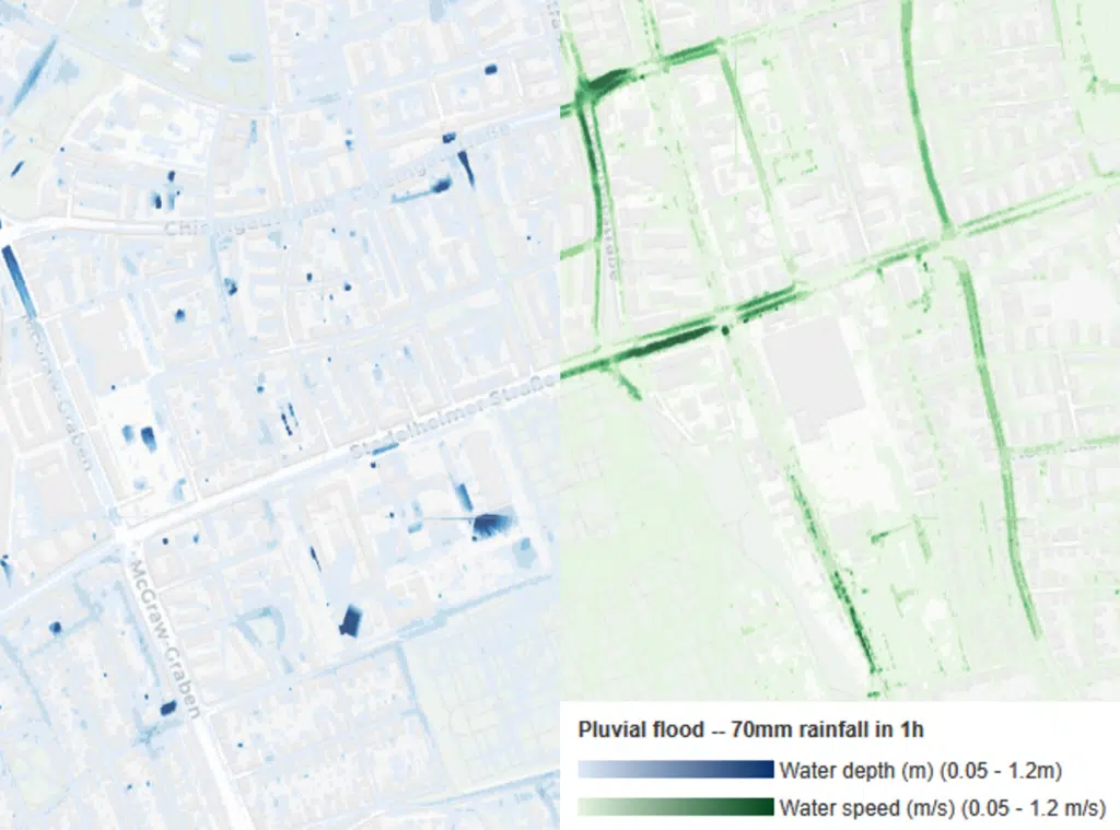
Pluvial flood risk is often determined at building and property level. High-resolution modelling reveals critical features such as access roads, loading ramps, building edges, depressions and local flow paths.
The simulation reflects the actual spatial environment. 3D buildings, terrain and soil characteristics influence where water flows and accumulates.
The model can incorporate climate-intensified heavy rainfall events, allowing users to assess how today’s exposure may change under future climate conditions.
Planned public or private flood protection measures can be incorporated directly into the model. This allows a simple comparison, so the effectiveness of a measure can be assessed before implementation.
Pluvial flood modelling integrates directly into Sustainaccount’s Climate Resilience Suite.
Where can flooding occur and at what intensity?
What does the flooding mean for the specific building, infrastructure or process?
What damage, losses or financial exposure could result?
Which measures reduce the risk and what residual risk remains?
For pluvial flood management, climate adaptation planning, neighbourhood development and the assessment of public protection measures.
For testing planning alternatives, terrain modifications, retention solutions and resilient site design.
To identify flood risks early in the planning process and avoid expensive retrofits later.
For existing-asset assessments, CAPEX planning, due diligence and adaptation prioritisation.
For more detailed physical risk assessment where conventional portfolio screening or hazard scores are not sufficient.
As technical evidence for climate risk and vulnerability assessments, for example in the context of the EU Taxonomy, DGNB or BREEAM.
For identifying critical areas across production, logistics, energy and infrastructure sites.
Where does water accumulate today?
How does more intense rainfall change the situation?
How do buildings or terrain modifications affect water flows?
How effective is a planned protection measure?
What are the consequences for buildings and operations?
Whether you are assessing a single building, corporate facility, industrial site, development project or municipal area, we tailor the modelling to your specific question and can integrate the results into a broader climate risk and adaptation assessment.